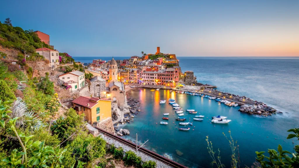
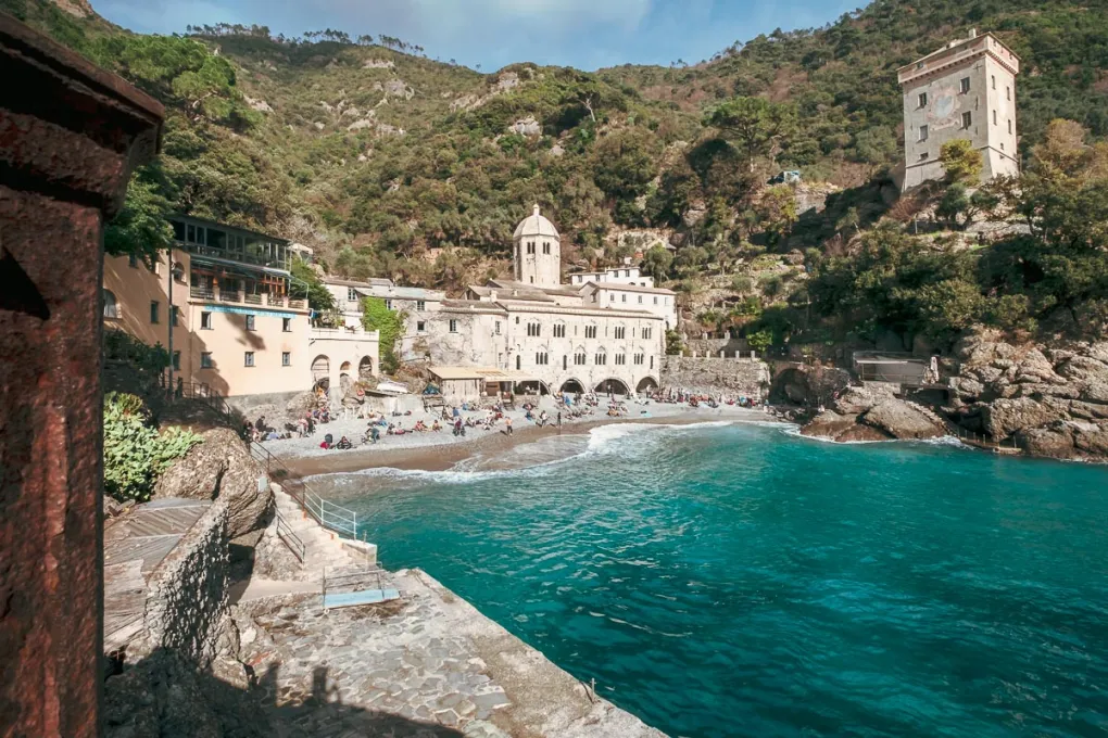
Liguria is not only beaches and harbors. A wild ridge crowns the region, the Alta Via dei Monti Liguri. It crosses the Ligurian Alps and Apennines. Sea views meet alpine meadows in one sweep. Villages rest in quiet valleys below. Old mule tracks tie peaks and passes together.

Jump to
ToggleOverview
The trail runs west to east across Liguria. It starts near Ventimiglia and ends near Ceparana in Bolano, La Spezia province. The full length is about 430–440 km, divided into 43–44 stages. You can combine or split them depending on time and pace.
Waymarking is clear. Look for red‑white‑red blazes with the letters “AV.” Signs at junctions mark stages and passes. Some stretches overlap the Sentiero Italia, while others link with European trails E1 and E7. In clear weather navigation is easy, but fog demands a map or GPS track.
Why this route stands out
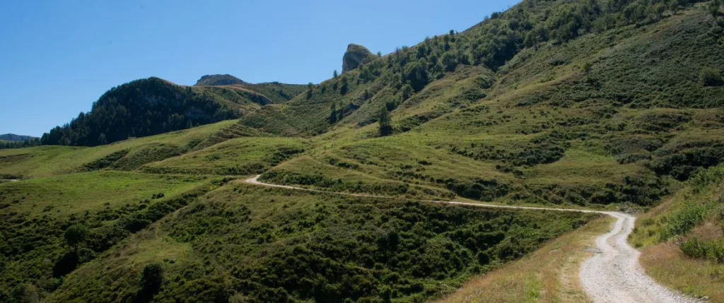
The ridge feels like a balcony above the coast. It keeps a steady height and avoids extreme climbs. Scenery changes quickly: beech woods, sandstone crests, and broad pastures alternate. Raptors soar above, while deer and chamois hide in the folds.
Culture deepens the journey. You pass old military roads and seasonal drove paths. Hill villages keep chestnut traditions alive. Rifugi serve polenta, stews, and local cheese. At dusk the sea glows under the skyline and the Alps form a blue wall beyond.
The route by sections
Alpi Liguri: Ventimiglia to the high crest
The western arc feels alpine. Paths rise to breezy meadows and rocky points. Monte Saccarello, Liguria’s highest peak at 2,200 meters, crowns this sector. Views stretch to the Maritime Alps and the coast. Springs may run dry in summer, so carry extra water.
Beigua ridge and the UNESCO Geopark heart
The ridge broadens to the Beigua Global Geopark, a UNESCO site with vast horizons. Wind rules here, shaping each day. Stages near Faiallo and Passo del Turchino shine in good weather. On blue‑sky days the sea looks close enough to touch.
Antola highlands and quiet pastures
Beyond Genoa’s hinterland, Antola Park brings round hills and open fields. Lago del Brugneto sits in a calm basin. Old herding lines guide gentle walks. Food stops matter as much as views—expect fresh pasta and herbs.
Aveto beech woods and Monte Zatta
Forest shade returns. Aveto Park protects rare orchids and dense beech stands. Monte Zatta shows layered sandstone cliffs and natural ledges. Paths roll along the ridge, with side trails dropping to Tigullio villages if needed.
Val di Vara to Ceparana
The final sector points toward the Gulf of Poets. Trails link to Portovenere and Cinque Terre networks. The ridge softens near Ceparana, where many walkers celebrate with focaccia and a swim.
How many days do you need?
A full traverse takes three to four weeks. Fit hikers may join stages and finish faster. Allow rest days for weather shifts. A week gives a highlights tour: alpine drama in the west or Beigua’s smooth crests. For a long weekend, choose two or three stages near road passes.
Best time to go
Late spring to early autumn is best. June brings flowers and cool nights. July and August offer long daylight but can be hot. Start early and rest at midday. September has calm air and bright skies. Snow lingers in the west in spring, and ice can appear in early winter.
Difficulty and fitness
The trail keeps altitude but days can still be long. Ascent builds quickly across a week. Rocky tracks test ankles, so poles help. Water can be scarce in dry spells. Mark springs and refill in huts or villages.
Waymarking, maps, and GPX
Follow red‑white‑red blazes with “AV.” Carry GPX tracks and offline maps. Bring a power bank for long days. Paper maps add security in fog. Practice with your device before heading out.
Where to sleep
Rifugi, inns, and agriturismi line the route. Some lie on the ridge, others a short descent away. Book weekends early in summer. Confirm opening days in spring and autumn. Plan stages around both beds and water.
Getting there and moving around
The Ligurian coast has strong rail links. Ventimiglia and La Spezia connect to major lines. Buses climb valleys to passes, while taxis fill gaps. Many stages end near roads, making section hiking easy. Drivers should park carefully at passes and avoid blocking access.
Mountain biking and bikepacking
A bike variant follows much of the ridge. It combines dirt tracks, military roads, and quiet lanes. Some singletrack and short hike‑a‑bike remain. Wet sandstone is slick; summer dust reduces grip. Always yield to hikers.
Sample itineraries
Three days: Beigua ridge burst
Day 1: Arrive near Faiallo. Walk half a stage for sunset. Stay in a hut or small inn.
Day 2: Cross Beigua crests. Scan the horizon for the Alps. Rest again near Faiallo.
Day 3: Short stage out. Drop to the coast for a swim.
Seven days: West‑to‑central highlights
Day 1–2: Alpi Liguri warm‑up. Sleep in small inns, enjoy open meadows.
Day 3: Monte Saccarello day. Extend if weather is kind.
Day 4–5: Transfer to Faiallo. Walk the Beigua ridge, catch a sunset.
Day 6: Antola pastures and lake views.
Day 7: Exit to a rail hub. Celebrate by the sea.
Packing list
Trail shoes or light boots with grip
Trekking poles
Windproof and waterproof shell
Warm mid‑layer
Sun hat, sunglasses, sunscreen
Two‑liter hydration capacity
Power bank and cable
Offline maps and paper backup
First aid and blister kit
Cash for huts and bars
Headlamp for dawn or delays
Weather, safety, and etiquette
Ridge weather shifts fast. Wind can be fierce. Carry a shell year‑round. Start early in summer heat. Avoid high points during storms. Tell someone your plan. Signal fades on remote crests.
Respect closures and park rules. Stay on marked paths. Close gates behind you. Carry out all waste. Keep noise low near wildlife. Greet fellow hikers with a simple “buongiorno.”
Food and small joys
This is still Liguria. Focaccia fuels early starts. Walnut sauce and herb pies reward effort. In the west, taste mountain cheese and cured meats. Chestnuts shape autumn menus. Village bars add warmth with coffee and smiles.
Practical tips for smooth days
Check bed availability before finalizing stages
Carry extra water in summer
Keep feet dry, fit socks well
Tape hot spots early
Protect electronics in wind and fog
Learn a few Italian trail phrases
Conclusion
The Alta Via dei Monti Liguri is a true sea‑to‑Alps balcony. Choose a section that suits your time. Book key nights early. Download GPX tracks and wait for a good weather window. Pack light, walk steady, and let Liguria unfold one ridge at a time.
FAQs
How long is the route?
Around 430–440 km, split into 43–44 stages.
Where does it start and finish?
From Ventimiglia to Ceparana in Bolano, La Spezia province.
How many stages are there?
About 43–44, often combined or split by hikers.
What is the highest point?
Monte Saccarello at just over 2,200 meters.
Is it well marked?
Yes. Red‑white‑red blazes with “AV” guide the way.
When is the best time to go?
Late spring to early autumn. June and September are ideal.
Can beginners walk parts of it?
Yes. Short sections near road passes are accessible.
Can I hike hut‑to‑hut?
Yes. Rifugi, inns, and agriturismi sit on or near the ridge.
Is wild camping allowed?
Rules vary. Use official lodging unless clearly permitted.
Is there a bike option?
Yes, a mountain bike variant exists. Yield to hikers.
Do I need to filter water?
In summer, yes. Springs may be dry. Refill often.
How do I handle storms?
Start early, watch clouds, avoid high points in lightning.
Disclosure: This page may contain affiliate links. This means that we get a small commission from any purchase you make, at no additional cost to you!

